
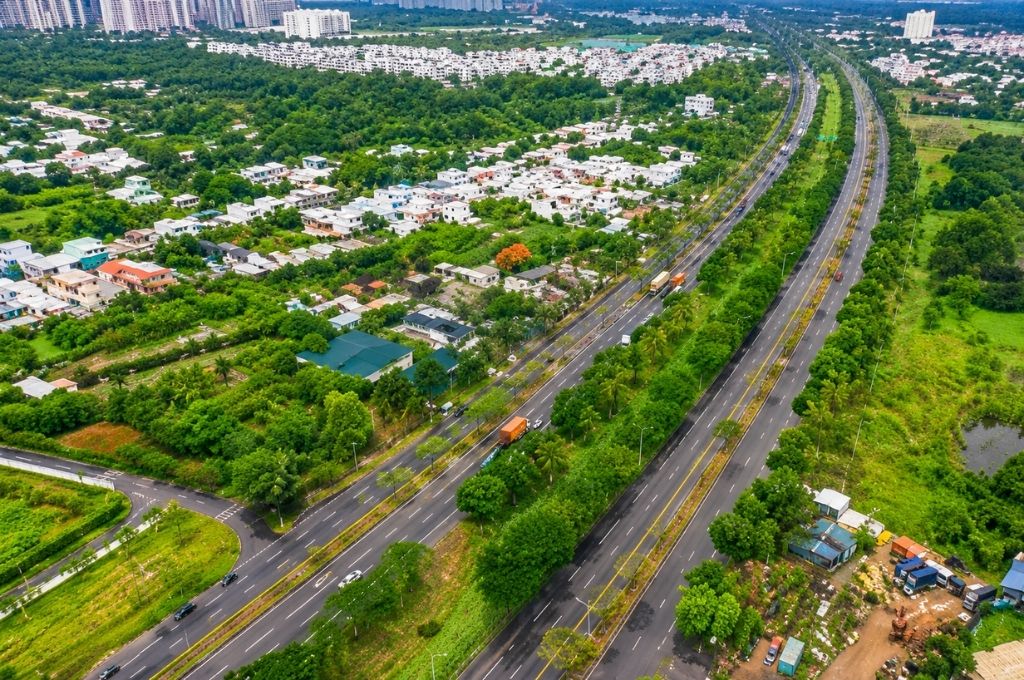
The Nguyen Van Linh Boulevard elevated road project is one of the most notable infrastructure proposals in South HCMC in 2026. According to the plan under study, the structure is about 17.8 km long, features a 6-lane scale, runs mainly on the median strip of Nguyen Van Linh Boulevard, and connects the Thu Thiem 4 Bridge area with National Highway 1.
Updated to July 26, 2026, the HCMC People’s Committee has assigned the Deo Ca – Tri Tin joint venture to study and prepare the investment policy proposal report under the public-private partnership (PPP) method. Topographic survey and measurement work has been implemented since early July 2026, but the project has not yet been approved for investment and has not officially commenced construction.
From an infrastructure analysis perspective, the greatest value of the elevated road lies not only in adding 6 lanes. The structure also has the ability to reorganize the vehicle flow on the entire East – West axis of the South area, separate a part of the through traffic from the inner-city traffic, and increase connection efficiency between National Highway 1, the South area of the city, the seaport area, and inter-regional transport projects.
OVERVIEW OF THE NGUYEN VAN LINH ELEVATED ROAD PROJECT
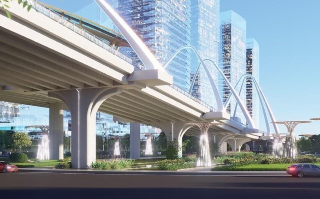
The Nguyen Van Linh elevated road is proposed to be built as a viaduct, arranged along the median strip of the existing road. The starting point is located at the Thu Thiem 4 Bridge connection area, and the ending point is at National Highway 1, forming an elevated traffic corridor of nearly 18 km through South HCMC.
WHERE IS THE NGUYEN VAN LINH ELEVATED ROAD PROJECT LOCATED?
The elevated road is being studied on the Nguyen Van Linh Boulevard corridor, one of the crucial East – West traffic axes of South HCMC. The existing route connects the National Highway 1 area in the West with the Tan Thuan, Huynh Tan Phat areas, and the approach to Phu My Bridge in the East.
According to the proposal, the starting point of the elevated road is located at the connection area of Thu Thiem 4 Bridge, near the Huynh Tan Phat axis. From here, the route goes West, follows Nguyen Van Linh Boulevard, and ends at the intersection with National Highway 1.
In terms of urban space, this is a strategic route direction. The East has the ability to connect to the central area via Thu Thiem 4 Bridge; the middle section of the route approaches Phu My Hung, Nguyen Huu Tho, Nguyen Luong Bang, and National Highway 50; the West links with National Highway 1 and the gateway to the Western provinces.
ROUTE ALIGNMENT OF THE NGUYEN VAN LINH ELEVATED ROAD
Thu Thiem 4 Bridge → Huynh Tan Phat → Nguyen Van Linh Boulevard → Nguyen Luong Bang → Nguyen Huu Tho → Pham Hung → National Highway 50 → National Highway 1
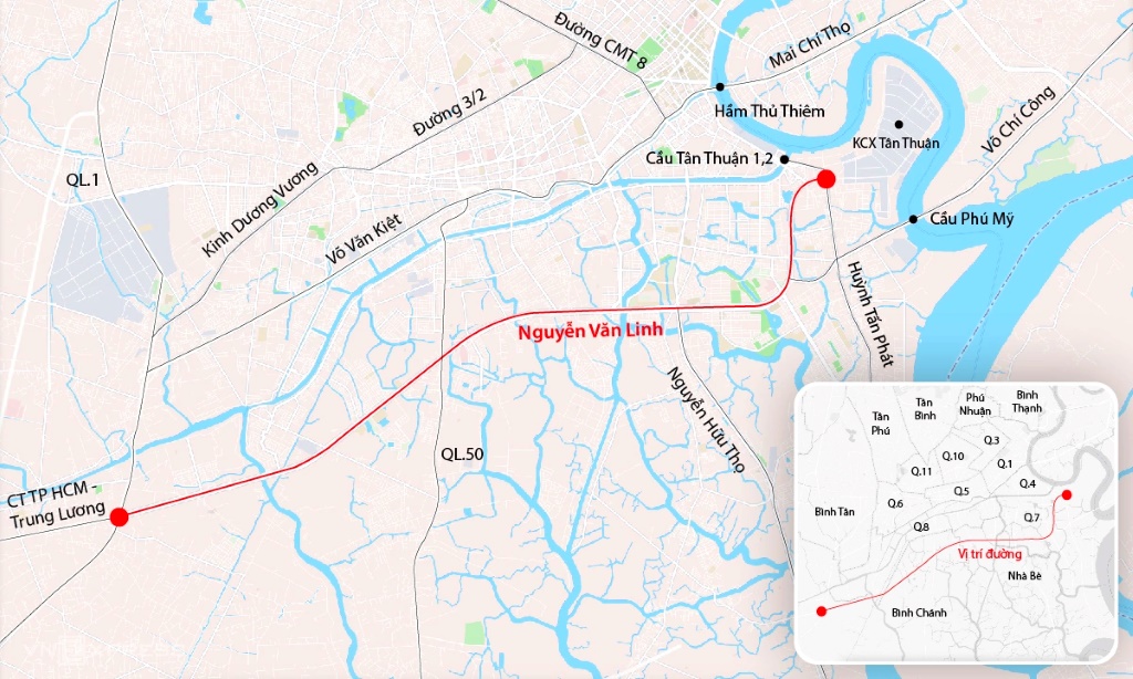
The proposed viaduct route runs mainly on the median strip of the existing boulevard. This plan utilizes the existing wide traffic corridor while limiting the need to expand the entire road surface into the residential areas on both sides.
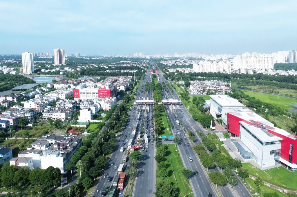
Nguyen Van Linh Boulevard currently has a scale of about 10–14 lanes, but there are still many at-grade intersections along the route. This is the reason why the actual operational capacity is not entirely commensurate with the wide cross-section, especially at intersections with a large volume of turning vehicles and trucks.
Arranging the elevated road in the middle of the boulevard can form two layers of traffic:
- The upper level mostly serves long-distance or through-traffic vehicles.
- The ground level continues to serve the needs of accessing residential areas, schools, commercial centers, and branch roads.
This organizational method can help reduce the number of stops at traffic lights for through vehicles, but the final effectiveness will depend significantly on the design of the on/off ramps and the vehicle reception capacity at major intersections.
6-LANE SCALE AND 7 GRADE-SEPARATED INTERCHANGES
According to the proposed plan, the elevated road section has a 6-lane scale. Along the route, 7 grade-separated interchanges are expected to be arranged at important areas.
Expected Interchanges
- Ring Road 2 Western Branch
- Inner Ring Road
- Pham Hung Street
- Nguyen Luong Bang Street
- Nguyen Huu Tho Street
- National Highway 50
- National Highway 1
In an urban elevated road project, interchanges and approach roads usually determine the majority of operational efficiency. If the on and off ramps are placed too close together, the merging and diverging traffic flows can cause conflicts. Conversely, if the distance is too far, the elevated route will struggle to serve the actual travel needs of the areas on both sides.
Therefore, the 7 interchanges are not just technical connection points. These are also locations capable of reorganizing the vehicle flow between the South area, the center of HCMC, National Highway 1, National Highway 50, and new development axes.
TOTAL INVESTMENT OF THE NGUYEN VAN LINH ELEVATED ROAD
The preliminary total investment of the project is proposed to be about 25,152 billion VND. The structure is being studied under the Public-Private Partnership (PPP) method, thereby mobilizing non-state resources for infrastructure development.
This capital level is not yet the approved total investment. The official cost will depend on the design plan, viaduct structure, interchange system, relocation of technical infrastructure, traffic organization, financial costs, and requirements arising during the project formulation process.
The HCMC People’s Committee has currently only assigned the Deo Ca – Tri Tin joint venture to prepare the investment policy proposal report. This does not mean the joint venture has been selected as the official investor, nor does it mean the payment method or the type of PPP contract has been approved.
LATEST PROGRESS OF THE NGUYEN VAN LINH ELEVATED ROAD IN 2026
The project has passed several notable preparation milestones:
March 2026: The Deo Ca – Tri Tin joint venture proposed investing in the elevated road along Nguyen Van Linh Boulevard.
April 2026: The HCMC Department of Construction commented on the necessity of studying the project in the context that the Nguyen Van Linh route has many at-grade intersections and vehicle traffic continues to increase.
May 2026: The HCMC People’s Committee approved assigning the Deo Ca – Tri Tin joint venture to study and prepare the investment policy proposal report under the PPP method.
Early July 2026: Engineers began topographic surveying and measurement on the median strip of Nguyen Van Linh Boulevard to collect data for the project study process.
Thus, the latest step is the field survey activity. This is the work to prepare the investment dossier, not the construction activity of the elevated road.
HAS THE NGUYEN VAN LINH ELEVATED ROAD COMMENCED CONSTRUCTION YET?
As of July 26, 2026, the project has not officially commenced.
The appearance of survey forces on the median strip does not mean the project has transitioned to the construction phase. The project is still in the process of preparing the investment policy proposal report and needs to continue implementing the steps of appraisal, approval, investor selection, design finalization, and preparation for deployment.
WHY IS HCMC STUDYING TO BUILD THE NGUYEN VAN LINH ELEVATED ROAD?
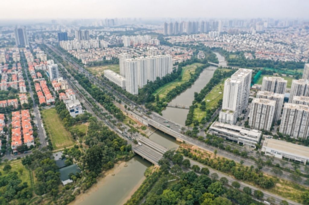
Nguyen Van Linh Boulevard is a major traffic axis connecting the Western area with the South and Eastern areas of HCMC. The route is planned with a right-of-way of about 120 m, but there are still many at-grade intersections, interrupting the vehicle flow and reducing continuous circulation capacity.
In the period up to 2030, the vehicle traffic on this axis is forecasted to endure additional impacts from many connecting projects such as the expansion of National Highway 1, National Highway 50, Ben Luc – Long Thanh Expressway, the North – South axis, Thu Thiem 4 Bridge, and the remaining sections of Ring Road 2.
According to the analysis of N.N REALTY, if only expanding the road surface while maintaining many at-grade intersections, the capacity of the entire route may continue to be limited at the intersections. The elevated road solution thus aims to create a continuous traffic flow, instead of merely adding more road surface at individual sections.
THE CONNECTIVITY ROLE OF THE NGUYEN VAN LINH ELEVATED ROAD
Forming the East – West corridor of the South area
The nearly 18 km elevated road can create a continuous traffic axis from National Highway 1 to the Thu Thiem 4 Bridge area. This is a corridor that helps link the Western gateway with the South area and the approach to the city center.
Increasing the exploitation efficiency of Southern Ring Road 2
Nguyen Van Linh Boulevard is a crucial part of the Ring Road 2 corridor. Organizing grade-separated traffic can improve the continuity of the route, especially when the missing sections of Ring Road 2 are completed.
Connecting the North – South traffic axes
The project intersects with many important routes such as Nguyen Huu Tho, Pham Hung, Nguyen Luong Bang, and National Highway 50. These are the axes that bring vehicles from the central area, Nha Be, Binh Chanh, and the seaport area to approach Nguyen Van Linh Boulevard.
Supporting transport and logistics
The Nguyen Van Linh axis receives a large volume of cars and freight vehicles between National Highway 1, South HCMC, the port system, and inter-regional traffic routes. The elevated line can add throughput capacity for this corridor when the connecting projects are deployed synchronously.
IMPACT ON SOUTH HCMC
The strategic value of the project lies in the ability to link multiple infrastructure structures into a network, instead of operating as an independent road.
In the East, the route connects to the Thu Thiem 4 Bridge area. At the center of the corridor, the elevated road intersects with Nguyen Huu Tho, which is continuing to be invested to connect to the Ben Luc – Long Thanh Expressway. In the West, the route approaches National Highway 1, one of the largest traffic gateways of HCMC.
If these projects are completed according to a relatively synchronous schedule, the South area can shift from a model dependent on a few frequently overloaded intersections to a network with multiple levels and more directions for distributing vehicles.
According to N.N REALTY, this is the most important impact: the elevated road can alter the accessibility structure of the entire area, not simply shortening travel time on a single road section.
IMPACT ON REAL ESTATE ALONG NGUYEN VAN LINH BOULEVARD
For the real estate market, a large-scale infrastructure project usually first impacts connectivity expectations. Areas near intersections, approach roads, and axes capable of receiving new traffic are often paid attention to earlier by the market.
If the Nguyen Van Linh elevated road is approved and implemented, areas that may benefit in terms of accessibility include the corridors of Phu My Hung, Nguyen Huu Tho, Nguyen Luong Bang, Pham Hung, National Highway 50, and the area bordering National Highway 1.
However, the level of benefit will not be even across the entire route. Real estate located near a convenient intersection but still ensuring the living environment may have an advantage over locations that are only adjacent to the viaduct but lack direct on and off ramps.
Real estate projects starting construction that benefit include Vlasta Premier Phu Thuan, Arcadia at Lavila, TT Genesis ……
WILL THE ELEVATED ROAD REPLACE THE EXISTING NGUYEN VAN LINH BOULEVARD?
The elevated road does not replace the existing Nguyen Van Linh route. According to the proposed plan, the viaduct is built on the median strip, while the lanes below continue to be exploited.
Regarding traffic organization principles, the upper level can serve the through-traffic flow, while the existing road surface continues to meet short-distance travel needs and access to the areas on both sides.
This model helps increase the capacity of the entire corridor without requiring all vehicles to use the elevated road.
FREQUENTLY ASKED QUESTIONS ABOUT THE NGUYEN VAN LINH ELEVATED ROAD
Conclusion
The Nguyen Van Linh Boulevard elevated road project has a proposed scale of about 17.8 km, 6 lanes, 7 grade-separated interchanges, and a preliminary total capital of over 25,000 billion VND. If approved and synchronously implemented, the structure can create an additional continuous traffic layer on the East – West axis of the South area, increasing connectivity between National Highway 1, Nguyen Huu Tho, the Phu My Hung area, and the direction of Thu Thiem 4 Bridge.
The latest update to July 26, 2026, shows that the project has begun field surveys but is still in the stage of preparing the investment policy proposal report. The structure has not been approved for investment, an official investor has not been selected, and construction has not commenced.
Therefore, the most notable value at present is the orientation to form an elevated traffic corridor through South HCMC. The milestones that need continuous monitoring are the results of the report preparation, investment policy decision, financial plan, investor selection, and official deployment plan.