
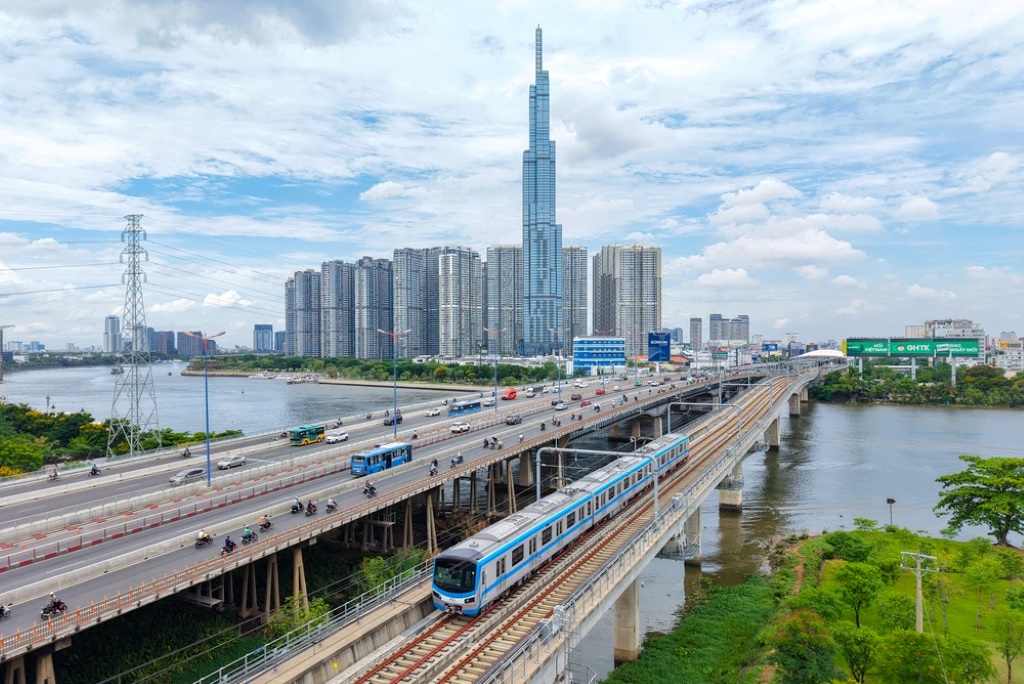
Overview of HCMC Metro Line 6
Ho Chi Minh City’s Metro Line 6 is oriented to become an inner ring urban railway, connecting Tan Son Nhat Airport with the East of the city and interconnecting with the Thu Thiem – Long Thanh line to form a public transport corridor between the two largest airports in the Southern region.
According to the mid-term feasibility study option updated in July 2026, the priority section from Tan Son Nhat – Phu Huu is nearly 23 km long, with 17 stations, including 13 underground stations and 4 elevated stations. The line is expected to arrange two underground stations within the Tan Son Nhat Airport area, directly connecting passenger terminals T1, T2, and T3.
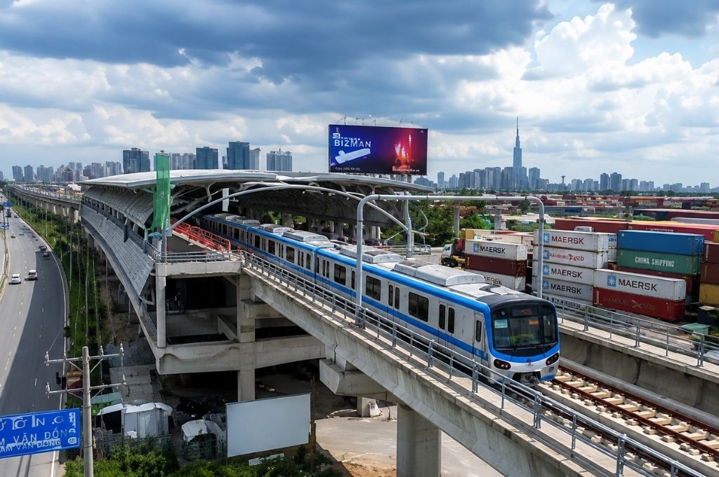
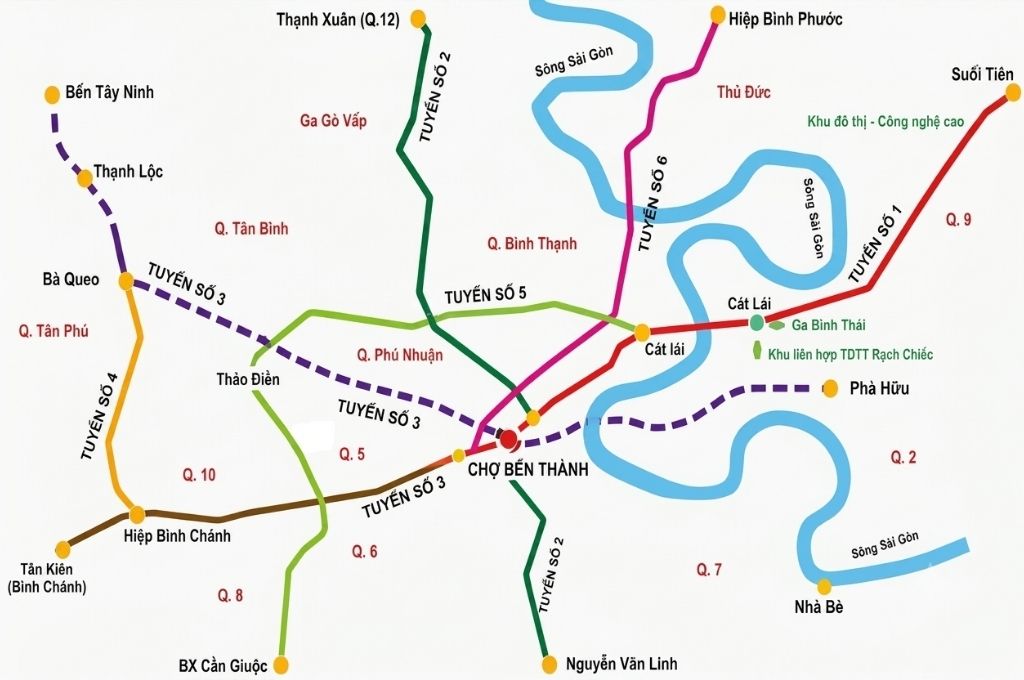
Metro Line 6 is part of the urban railway network adjusted according to HCMC’s development orientation to 2040, with a vision to 2060.
According to the list of projects attracting investment for the 2026–2030 period, the planning scale for the entire Metro Line 6 – Inner Ring is about 53.8 km long, with a preliminary total investment of about 211,602 billion VND. Among them, the section connecting the Tan Son Nhat Airport area with Phu Huu is prioritized for implementation first.
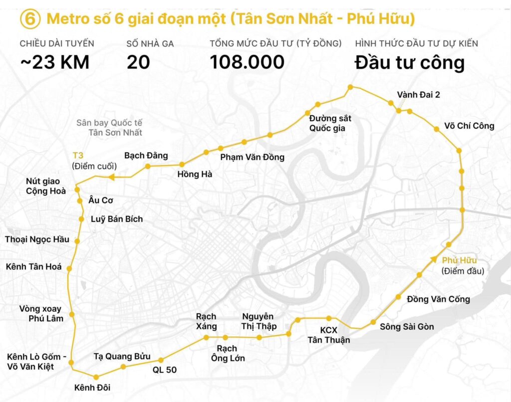
Expected parameters of Metro Line 6 Phase 1
Route of Metro Line 6 Tan Son Nhat – Phu Huu
The technical starting point of Phase 1 is arranged at Ba Queo station, code ST01, near the Tan Ky Tan Quy – Truong Chinh intersection. Here, passengers can transfer to Metro Line 2 Ben Thanh – Tham Luong.
From Ba Queo station, the line diverts to the east, going underground into the Tan Son Nhat International Airport area. The new plan proposes adjusting the location of Ba Queo station about 245 m to the north to increase connectivity and transfer capabilities between Metro Line 6 and Metro Line 2.
After Tan Son Nhat Airport, the line continues along the main corridors:
Ba Queo – Tan Son Nhat Airport – Hong Ha street – Nguyen Thai Son – Nguyen Kiem – Pham Van Dong Boulevard – Binh Trieu area – Thu Duc – Vo Nguyen Giap Boulevard – Ring Road 2 – Vo Chi Cong – Phu Huu bridge – Lien Phuong street – Phu Huu station.
On the Pham Van Dong axis, the stations are studied to be arranged near the North-South railway, Phan Van Tri and Nguyen Xi intersections. The line then goes underground across the Saigon River, continues towards Thu Duc, and connects with Metro Line 1 Ben Thanh – Suoi Tien in the Vo Nguyen Giap Boulevard area.
From the Ring Road 2 area, the line gradually transitions from underground to elevated, crossing the Vo Chi Cong intersection, Phu Huu bridge, and Lien Phuong street. After ST16 station, the line is expected to split into one branch to the final station ST17 and another branch connecting directly to the Thu Thiem – Long Thanh railway.
Two Underground Metro Stations in Tan Son Nhat Airport
One of the most notable changes in the new plan is the arrangement of two underground stations right inside the Tan Son Nhat Airport area.
ST02 Station connecting to Terminal T3
Station ST02 is planned to be located west of Terminal T3, consisting of two underground floors with a total area of over 12,500 m².
Compared to the old plan, the route alignment is straightened, and the station is brought closer to passenger Terminal T3. The two smaller stations in previous planning are studied to be consolidated into one large station to avoid overlapping service areas and reduce the number of stops.
ST03 Station connecting Terminals T1 and T2
After ST02, the line goes underground beneath the aircraft parking apron to ST03 station, planned to be located at the parking lot between domestic Terminal T1 and international Terminal T2.
Station ST03 is studied with three underground floors, covering an area of about 18,600 m². This is also the expected transfer point with Metro Line 4 Dong Thanh – Hiep Phuoc.
The arrangement of stations ST02 and ST03 allows passengers from all three terminals (T1, T2, and T3) to access the metro system more conveniently, reducing the demand for personal cars, taxis, and ride-hailing vehicles when entering and exiting the airport.
List of Key Stations
As of July 2026, the stations on the line are primarily announced by codes from ST01 to ST17. The official names and coordinates for all 17 stations have not been finally approved.
Some key locations that have been identified in the research plan include:
| Station Code / Area | Expected Location | Connection Function |
|---|---|---|
|
🚇
ST01 |
Ba Queo – Truong Chinh | Connects to Metro Line 2 |
|
🚇
ST02 |
West of Terminal T3 | Serves Tan Son Nhat Terminal T3 |
|
🚇
ST03 |
Between Terminal T1 and T2 | Connects Airport and Metro Line 4 |
|
🚇
ST04 |
Hong Ha street, near Nguyen Thai Son – Nguyen Kiem | Serves the airport gateway area |
|
🚉
Pham Van Dong Stations |
Near North-South railway, Phan Van Tri, Nguyen Xi | Serves Go Vap, Binh Thanh, and the northern area |
|
🚇
ST12 |
Vo Nguyen Giap Boulevard | Connects to Metro Line 1 |
|
🚇
ST16 |
Lien Phuong street area | Branching preparation point |
|
🚇
ST17 |
Phu Huu – Long Truong area | Connects Thu Thiem – Long Thanh |
Will Metro Line 6 Be Entirely Underground?
Some previous research plans mentioned making the entire Tan Son Nhat – Phu Huu section underground. However, the mid-term feasibility study report from July 2026 proposes:
- Approx. 18.7–19 km underground.
- Approx. 4 km elevated.
- 13 underground stations.
- 4 elevated stations.
The elevated section mainly lies towards the East, after the Ring Road 2 area, heading across Vo Chi Cong, Phu Huu bridge, and Lien Phuong street.
This change indicates that the design of Metro Line 6 is still being optimized based on construction costs, geological conditions, site clearance capabilities, operational organization, and connectivity with other railway lines.
Expected Technology and Operational Capacity
The consulting unit proposes that Metro Line 6 use technical standards similar to Metro Line 2, the Tham Luong – Ben Thanh – Thu Thiem section.
The maximum operating speed is expected to range from 80 km/h to 110 km/h depending on the section. The trains can use a three-car configuration in the initial stage and are designed to increase to six cars as passenger demand grows.
Synchronizing standards with Metro Line 2 can facilitate operations, maintenance, human resource training, and gradually standardize HCMC’s urban railway system.
Total Investment for Metro Line 6
Total planned route investment
The entire Metro Line 6 – Inner Ring, measuring about 53.8 km long, has a preliminary total investment of approx. 211,602 billion VND according to HCMC’s list of projects attracting investment for 2026–2030.
Phase 1 investment
The priority section from Tan Son Nhat – Phu Huu, measuring about 22.85–22.9 km, is estimated to require approx. 86,529 billion VND. This estimate may change after finalizing the feasibility study report, technical design, and site clearance plan.
Latest Progress of Metro Line 6 in 2026
As of late July 2026, Metro Line 6 has not officially started construction. The project is in the stage of finalizing the route alignment, station locations, and the feasibility study report.
- July 2026: Posting documents, gathering community feedback on the route and facility locations.
- Year 2026: Finalizing the feasibility study report and project approval procedures.
- End of 2026: Targeting to commence construction of Phase 1.
- Year 2030: Goal to complete and put into operation.
The project targets approval in November 2026, commencement on December 31, 2026, and completion by the end of 2030.
Role in Connecting Tan Son Nhat – Long Thanh Airports
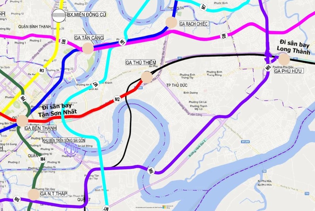
Metro Line 6 does not run independently from Tan Son Nhat to Long Thanh Airport. The line covers the Tan Son Nhat – Phu Huu segment, then interconnects with the Thu Thiem – Long Thanh railway to continue the journey to Long Thanh Airport.
When these projects are completed synchronously, passengers can travel along the itinerary:
Tan Son Nhat – Metro Line 6 – Phu Huu Station – Thu Thiem-Long Thanh Line – Long Thanh Airport.
This corridor helps add a mass transit option alongside the HCMC – Long Thanh – Dau Giay expressway, simultaneously reducing reliance on personal cars and road transport.
Metro Lines Connecting with Metro Line 6
Metro Line 6 is oriented to connect with several important railway lines:
Metro Line 2 at Ba Queo Station
Station ST01 is expected to connect with Metro Line 2 Ben Thanh – Tham Luong, helping passengers from the airport area and the east access the city center.
Metro Line 4 at Tan Son Nhat Airport
Station ST03 between Terminal T1 and T2 is studied to become a transfer point with Metro Line 4 Dong Thanh – Hiep Phuoc.
Metro Line 1 at Vo Nguyen Giap Boulevard
Station ST12 is expected to connect to Metro Line 1 Ben Thanh – Suoi Tien, opening transfer possibilities to the HCMC center, Hi-Tech Park, and the new Mien Dong Bus Station.
Thu Thiem – Long Thanh Line at Phu Huu
This is a strategic connection to form an interconnected railway line between Tan Son Nhat Airport and Long Thanh Airport.
How Will Metro Line 6 Impact the Real Estate Market?
In the long term, Metro Line 6 can create a new urban development corridor from the Tan Binh, Go Vap, Binh Thanh areas to Hiep Binh, Thu Duc, Phuoc Long, Tang Nhon Phu, Long Truong, and Phu Huu.
Increasing accessibility
Areas near the stations have the potential to shorten connection times to the airport, the center, and inter-regional transport hubs. This is a factor that can support the demand for housing, offices, commerce, and services.
Forming TOD urban areas
The TOD model concentrates housing, commerce, offices, and public amenities within walking distance around stations. If implemented synchronously, TOD can change construction density, land use structure, and the form of urban development along the line, such as Gladia Khang Dien.
Creating advantages for East HCMC
The Vo Nguyen Giap, Ring Road 2, Vo Chi Cong, Lien Phuong, and Phu Huu areas are likely to benefit from the simultaneous connection of Metro Line 1, Metro Line 6, Ring Road 2, and the Thu Thiem – Long Thanh line.
Outlook Assessment of Metro Line 6
Metro Line 6 has three prominent strategic values.
- Directly connecting the entire complex of terminals T1, T2, and T3 of Tan Son Nhat Airport with the metro network.
- Creating a ring transfer route between Metro Line 2, Metro Line 4, Metro Line 1, and the Thu Thiem – Long Thanh railway.
- Opening a public transport corridor between the two airports, Tan Son Nhat and Long Thanh, without forcing passengers to travel through the central HCMC area.
Frequently Asked Questions
Conclusion
HCMC’s Metro Line 6 is moving from the master planning phase to investment preparation for the priority section from Tan Son Nhat – Phu Huu.
The updated plan from July 2026 shows the line is nearly 23 km long, comprising 17 stations, including 13 underground and 4 elevated stations. Two underground stations are arranged within Tan Son Nhat Airport to directly serve terminals T1, T2, and T3.
If implemented on schedule and interconnected with the Thu Thiem – Long Thanh line, Metro Line 6 will become a crucial link in HCMC’s public transport network, while creating momentum for urban development in the Tan Binh – Pham Van Dong – Thu Duc – Phu Huu corridor.