HCMC Metro Line 10: Planning and Route Alignment
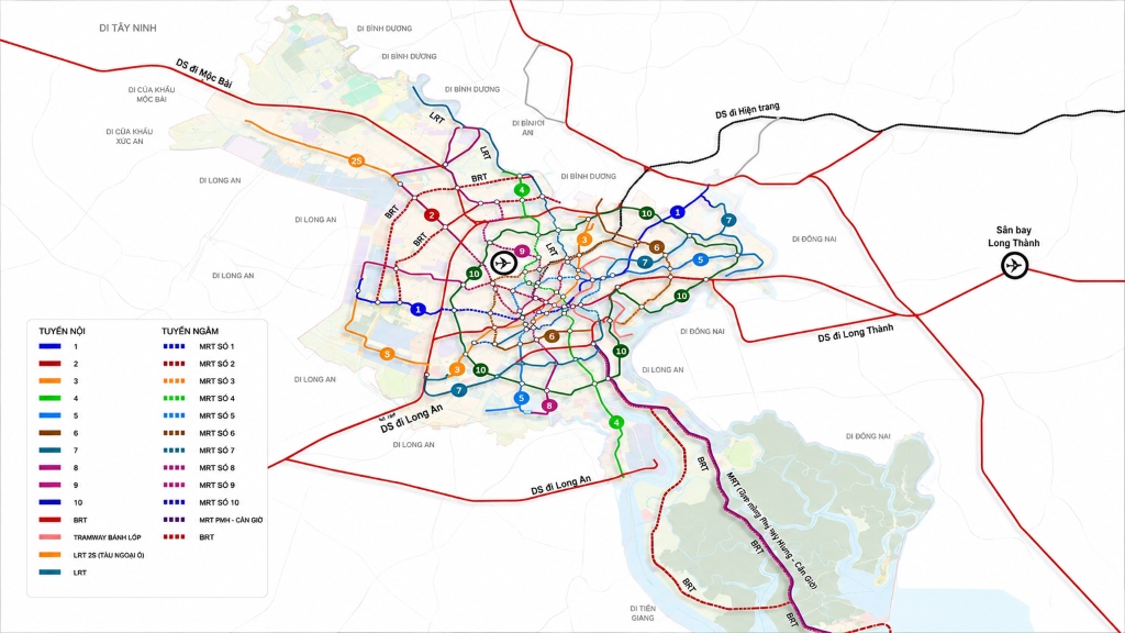
HCMC Metro Line 10 is oriented as an outer ring urban railway line, connecting a series of important development areas from Thu Thiem, Cat Lai, Long Phuoc, Hi-Tech Park to the North, West, and South areas of the city.
With an estimated length of about 84 km, Metro Line 10 has a different role compared to radial metro lines. Instead of mainly bringing passengers from the suburbs to the center.
The line is being studied to form a closed public transport corridor, helping people move between urban areas without having to pass through the existing central area.
However, as of 2026, Metro Line 10 is still in the planning stage. The route alignment, station locations, length, and specific investment plans will continue to be determined in the next specialized research steps.
Overview of HCMC Metro Line 10
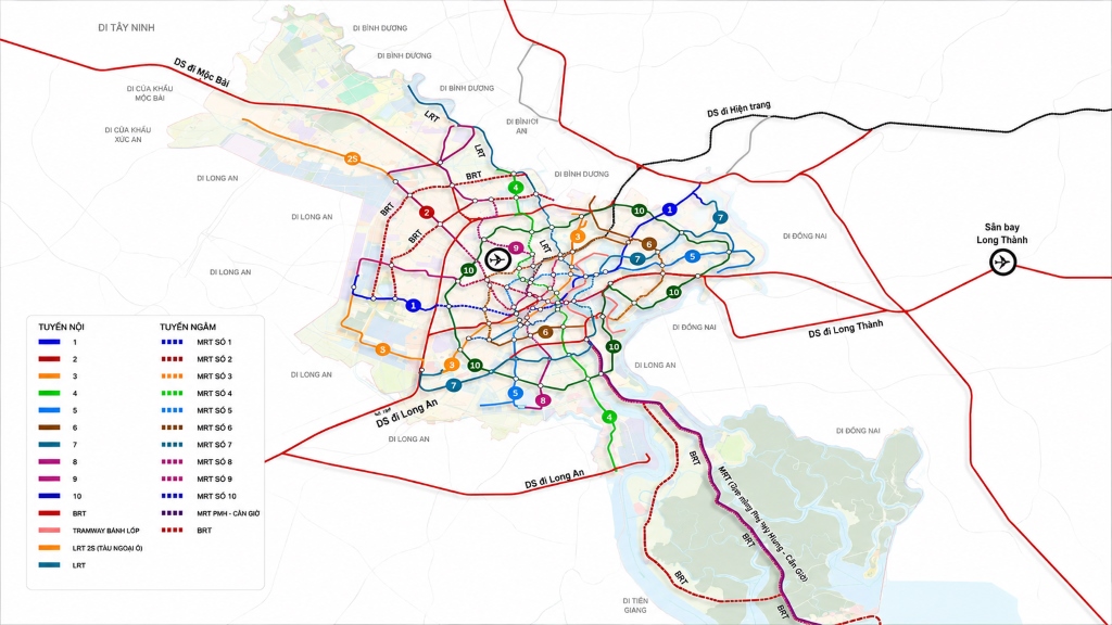
Metro Line 10 is identified in the development orientation of the HCMC urban railway network. Decision No. 1125/QD-TTg dated June 11, 2025, of the Prime Minister approved the Adjustment Project of the HCMC General Master Plan to 2040, with a vision to 2060, creating a basis for the city to continue perfecting its high-capacity public transport system.
Specifically in the general planning of the former Thu Duc City area, the urban railway network is oriented to include lines MRT 1, MRT 2, MRT 3, MRT 5, MRT 6, MRT 7, and MRT 10. The planning also mentions the construction of urban railway depots in Hiep Binh Phuoc and Long Truong.
| Item | Expected Information |
|---|---|
|
🚇
Line Name |
HCMC Metro Line 10 |
|
🚆
Nature |
Outer ring urban railway line |
|
📏
Length |
Approximately 84 km |
|
🔗
Key Connection Points |
Thu Thiem, Cat Lai, Long Phuoc, Hi-Tech Park, Linh Trung, Binh Phuoc, West, and South areas |
|
🗺️
Service Area |
East, North, West, and South areas of HCMC |
|
📋
Status in 2026 |
Under planning, not yet commenced |
|
🚉
Number of Stations |
Not officially announced |
|
💰
Total Investment |
Not officially approved |
|
⏳
Completion Time |
No officially confirmed timeline |
Some planning documents record an estimated length of about 83.9 km, while some long-term metro network development schemes provide a figure of about 87.84 km. The difference may come from the scope of study, connection plans, and route adjustments through each phase. Therefore, when communicating, the phrase “approximately 84 km long according to the expected planning” should be used.
Where is the proposed route of HCMC Metro Line 10?
According to research documents serving the adjustment of the general master plan, Metro Line 10 is developed on the basis of extending an urban railway line in the East area to form a closed ring line.
The preliminary route alignment is proposed as follows:
Thu Thiem Station – Truong Van Bang Street – Cat Lai – Tam Da – Long Phuoc – Hi-Tech Park – Linh Trung – National Highway 1 – Binh Phuoc area – An Phu Dong – Vam Thuat River – Tham Luong Canal – West HCMC area – Binh Chanh – Nha Be – Dao Tri – Tan Thuan – back to Thu Thiem.
This is only the route at the planning level. The locations of tracks, passenger stations, depots, transit points, and land recovery boundaries can only be determined after the project has an approved pre-feasibility study report, feasibility study report, and detailed planning.
Section through the East of HCMC
The East area is one of the most important areas on the Metro Line 10 route. The line is expected to start or connect at Thu Thiem station, then pass through Truong Van Bang, Cat Lai, Tam Da, Long Phuoc, Hi-Tech Park, and Linh Trung areas.
Thu Thiem
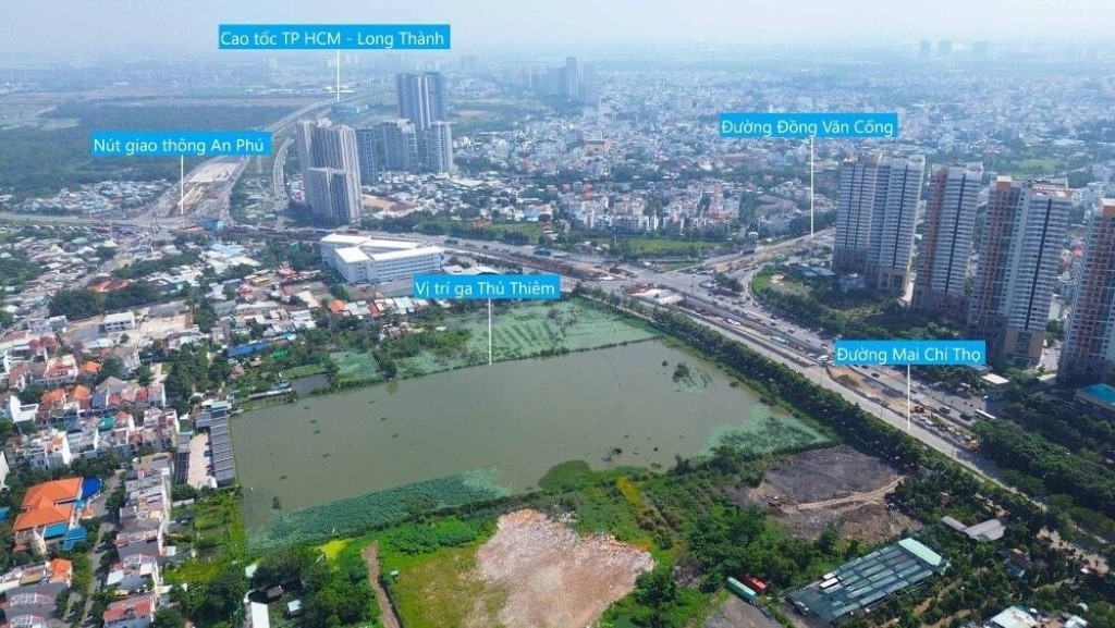
Thu Thiem is oriented to become the new financial, commercial, and service center of HCMC. This area is also the hub for many urban and inter-regional railway lines.
Once the network is completed, passengers from Metro Line 10 can access lines going to the city center, Long Thanh airport, and new development areas in the East.
Cat Lai – Thanh My Loi
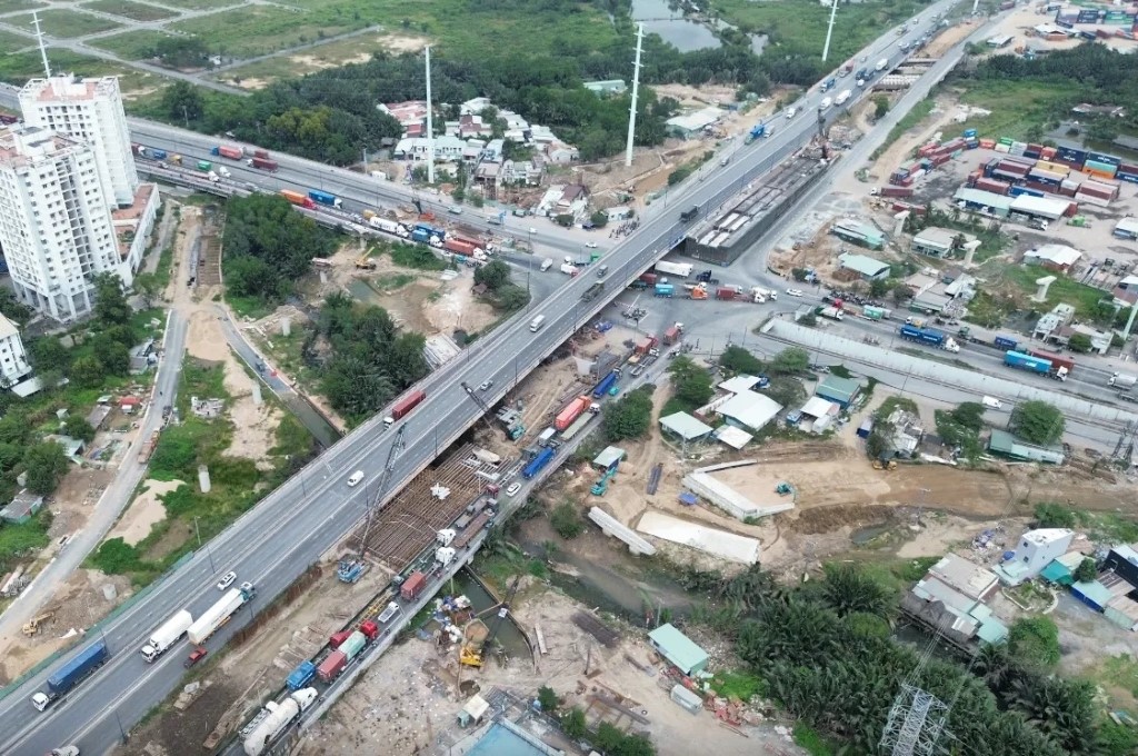
Cat Lai is currently a major port and logistics hub. However, the area is frequently under pressure from container trucks, lorries, and increasing personal vehicles.
Metro Line 10 is expected to create an additional public passenger transport method, reducing reliance on personal vehicles and supporting connections between residential areas around Cat Lai, Thanh My Loi with Thu Thiem and neighboring areas.
Tam Da – Long Phuoc
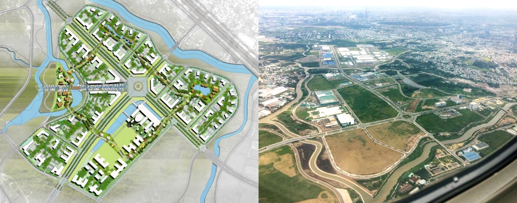
Long Phuoc is oriented to develop research, training, and innovation functions. The regional planning also mentions organizing commercial and service urban areas around stations, urban railway depots, and traffic hubs in Tam Da.
If Metro Line 10 is implemented, the Tam Da – Long Phuoc area will have the conditions to form urban development clusters linked to public transport instead of relying solely on roads.
Hi-Tech Park – Linh Trung
The Hi-Tech Park, VNU-HCM, Linh Trung, and nearby industrial parks concentrate a large number of workers, experts, and students.
Connecting this area with the ring metro line can help redistribute travel demand and simultaneously increase accessibility between training centers, tech production hubs, and residential areas.
Section through the North and Northwest of HCMC
After passing Linh Trung and National Highway 1, the line is expected to continue connecting the Binh Phuoc area, An Phu Dong, Vam Thuat River, and Tham Luong Canal corridor.
This is a high population density area, with many roads frequently experiencing traffic pressure during rush hours. Metro Line 10 can play a role in transshipping passengers between the East, North, and West areas without going through the central area.
The ring route alignment also facilitates connections with radial metro lines, trunk buses, bus stations, and inter-provincial traffic hubs.
Section through the West of HCMC
From the Tham Luong Canal corridor, Metro Line 10 is expected to approach the Ma Lo, Tan Tao, Ho Hoc Lam areas, the high-tech medical park, and Western residential areas.
The West of HCMC currently has many industrial parks, long-standing residential areas, and new urban projects. However, high-capacity public transport here is still limited.
In the long term, the ring metro line can support:
- Connecting residential areas with industrial parks and employment centers.
- Reducing pressure on radial road axes.
- Creating transit points to other metro lines.
- Forming commercial and service centers around stations.
- Increasing accessibility for Western urban areas.
Section through the South of HCMC
After the West area, the line is studied to pass through Binh Chanh, Phong Phu, Nhon Duc, Nguyen Binh, Dao Tri, Tan Thuan areas and connect back to Thu Thiem.
This is a section of significant importance to the development of the South area. Currently, commuting between Nha Be, Binh Chanh and the East area mostly relies on roads and has to pass through many congested points.
If established, Metro Line 10 could create a more direct public transport corridor between the South, East areas, and new development centers.
Why is Metro Line 10 called the outer ring line?
Most conventional metro lines are organized radially, meaning they connect the periphery with the city center.
Metro Line 10 is studied under a ring model, helping to connect radial lines together. Passengers can transfer at intersecting stations without having to go deep into the central area.
For example, in the future, a passenger from the South area wanting to go to the Hi-Tech Park can use the ring line or transfer at a suitable hub, instead of having to go through the Ben Thanh area.
This model can help:
- Redistribute passenger flow.
- Reduce pressure on central stations.
- Shorten some inter-regional journeys.
- Increase operational efficiency of the entire metro network.
- Limit personal vehicles traveling across the city center.
The role of Metro Line 10 in the HCMC transport network
Connecting radial metro lines
A ring line only maximizes its efficiency when synchronously connected with other urban railway lines. Metro Line 10 is expected to become a bridge between lines originating from the center to the East, West, North, and South areas.
As a result, the entire system can operate as a network rather than individual, isolated railway lines.
Connecting new economic centers
The proposed route approaches many key development areas such as:
- Thu Thiem urban center.
- Cat Lai port and logistics area.
- HCMC Hi-Tech Park.
- Industrial parks in the North and West.
- Urban, service, and research areas in Long Phuoc.
- New residential areas in Binh Chanh and Nha Be.
- Tan Thuan Export Processing Zone and urban area.
The connection between employment centers and residential areas is an important factor helping to reduce travel time and allocate population more rationally.
Supporting TOD urban development
TOD is a transit-oriented development model focused around public transport stations. Areas near stations are often planned to integrate housing, offices, commerce, services, pedestrian spaces, and transit parking lots.
The East area planning has mentioned arranging public parking lots associated with stations, developing TOD centers, and integrating commercial, service, and training functions to exploit land efficiently.
Metro Line 10 can facilitate the formation of multiple TOD centers in peripheral areas, contributing to reducing development pressure on the existing central area.
How does Metro Line 10 impact real estate?
High-capacity public transport infrastructure is often one of the factors influencing urban development. However, the actual impact of the metro on real estate does not occur evenly across all locations.
Increasing accessibility
Real estate properties located near stations, with convenient walking paths and good connections to other transport routes, often have a higher advantage than projects merely advertised as “near the metro” but far from boarding points.
Promoting commerce and services
Station areas can attract shops, offices, F&B services, shopping malls, and business activities serving passengers.
Supporting new urban development
Areas like Long Phuoc, Tam Da, Phong Phu, Nhon Duc, or land funds along the metro corridor can be studied for development towards compact cities, utilizing land efficiently and prioritizing public transport.
Evaluating the potential of HCMC Metro Line 10
Metro Line 10 has a strategic meaning in forming a complete urban railway network for HCMC. The line helps connect areas outside the central core, facilitating travel between the East, North, West, and South areas.
For the real estate market, the line can become a long-term development driver in Thu Thiem, Cat Lai, Long Phuoc, Hi-Tech Park, Binh Phuoc, Binh Tan, Binh Chanh, Nha Be, and Tan Thuan. Benefiting projects in the South area include Arcadia at Lavila, TT Genesis, …etc.