
Overview of Nguyen Huu Tho Elevated Road Project
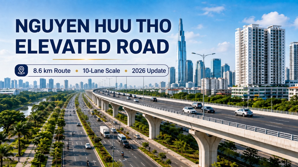
Nguyen Huu Tho elevated road is the central component of the North-South axis road upgrading project, section from Nguyen Van Linh street to Ben Luc – Long Thanh expressway. The project is planned on the existing Nguyen Huu Tho axis, aiming to form a high-speed traffic route connecting the center of Ho Chi Minh City with the South area, Hiep Phuoc urban – port area, and the inter-regional expressway and ring road network.
According to the plan being implemented, the entire project is about 8.6 km long, 60 m wide, including 4 elevated car lanes and two parallel roads below with a total of 6 traffic lanes. The estimated total investment is 9,894 billion VND, implementation period is from 2025 to 2028.
Where is Nguyen Huu Tho elevated road located?
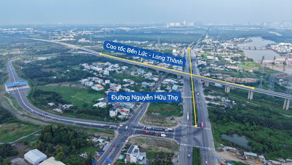
The route is built along the existing Nguyen Huu Tho street, starting from the intersection with Nguyen Van Linh avenue and extending southwards to Ben Luc – Long Thanh expressway.
The project scope currently belongs to Nha Be commune and Hiep Phuoc commune, corresponding to the area of District 7 and Nha Be district before HCMC adjusted its administrative units. This is an important traffic axis connecting Saigon South with Hiep Phuoc urban – port area, southern industrial zones and the inter-regional traffic network.

Route alignment of Nguyen Huu Tho elevated road
The main route alignment is organized along the North-South axis with important connection areas:
- Nguyen Van Linh – Nguyen Huu Tho intersection.
- Rach Dia bridge area.
- Warehouse B connecting road according to planning.
- Vinh Phuoc – Cay Kho area.
- Cross roads connecting residential and urban areas in Nha Be.
- Nguyen Huu Tho – Ben Luc – Long Thanh expressway intersection.
The main viaduct item is studied from abutment M2 of Rach Dia bridge to near the end of the route, with a length of about 6.62 km. The two intersections at the beginning and end of the route are invested by budget capital in a separate component project to ensure synchronous connection.
The 10-lane scale of Nguyen Huu Tho street after upgrading
Upon completion, the entire route’s cross-section is expected to be about 60 m wide with a total of 10 traffic lanes.
4-lane elevated car road
The viaduct is located in the middle area of the route, consisting of 4 lanes for cars, with a design speed of about 80 km/h. The solution of limiting intersections helps through-traffic, expressway traffic or port traffic avoid having to continuously merge into the civil traffic flow below.
Cars using the elevated route are expected to pay tolls under a BOT contract. The toll rate, toll collection period and toll station locations will be determined in the official project contract and financial plan.
6-lane parallel roads below
Below the viaduct, there are two parallel roads, 3 lanes on each side, along with sidewalks and connection systems to residential areas, urban projects and cross roads.
Parallel roads are designed to serve local traffic, including motorcycles, cars and vehicles needing access to structures along the route. The expected maximum operating speed is about 60 km/h.
Architectural design inspired by mangrove roots
The architectural plan code BN01 of the consortium of B.R Design Consulting Co., Ltd. and NDA Vietnam Co., Ltd. won the highest prize in the architectural competition for the main overpass.
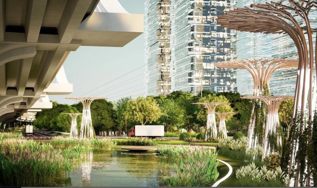
The plan uses curves and arch structures inspired by mangrove roots, a typical image of the mangrove ecosystem in South HCMC. The City People’s Committee assigned the Department of Construction to guide the consulting unit to absorb the council’s opinions and complete the design to implement the next steps.
Proposed landscape solutions include:
- Artistic lighting for the bridge body and arch structures.
- Planting trees, flowers and arranging landscapes under the bridge.
- Installing noise barriers at sections near residential areas.
- Organizing pedestrian bridges in areas with high connection demand.
- Creating open spaces to limit the heavy feeling of the viaduct structure.
- Arranging connection spaces with future Metro Line 4 stations.
Total investment of nearly 9,900 billion VND
The preliminary total investment of the entire project is 9,894 billion VND, divided into two component projects.
Component project 1: Budget capital
Component project 1 has a total investment of about 3,596 billion VND, using budget capital to implement:
- Compensation, support and resettlement.
- Relocation of technical infrastructure.
- Complete construction of Nguyen Van Linh intersection.
- Construction of the intersection with Ben Luc – Long Thanh expressway.
- Site preparation for the BOT project.
Component project 2: PPP – BOT
Component project 2 has a total investment of about 6,298 billion VND, including loan interest. In which:
- State budget participates with about 1,084 billion VND, equivalent to 17%.
- Capital mobilized by investors is about 5,214 billion VND, equivalent to 83%.
Latest progress of Nguyen Huu Tho elevated road in 2026
Implemented milestones
February 2025: HCMC People’s Council approved the project investment policy.
March 31, 2025: HCMC People’s Committee issued Decision No. 1229/QD-UBND, assigning preparation tasks and investors for the two component projects.
2025: The city implements the preparation of feasibility study reports, contractor selection plans and architectural plan competitions for the main overpass. The contractor selection plan for component project 2 has been published with the HCMC Department of Construction as the implementing agency.
January 2026: Architectural plan BN01 was approved for the competition results, serving as a basis for completing the design.
Implementation plan
According to the announced detailed plan:
- Q2/2026: Bidding to select investors and sign BOT contract.
- Q3/2026: Preparing, appraising and approving technical designs.
- Q4/2026: Commencing construction.
- Q4/2028: Completion and putting into operation.
The role of two major intersections
Nguyen Van Linh – Nguyen Huu Tho intersection
This area already has two underpasses serving the traffic flow on Nguyen Van Linh street. The new project will continue to complete the intersection, supplementing overpasses and connecting branch systems suitable for the elevated route.
When invested synchronously, the intersection can separate traffic flows in the East-West direction on Nguyen Van Linh and the North-South direction on Nguyen Huu Tho, reducing conflicts at one of the crowded gateways in the South area.
Ben Luc – Long Thanh expressway intersection
The intersection at the end of the route helps vehicles from Nguyen Huu Tho connect directly to the Ben Luc – Long Thanh expressway and the Ring Road 3 network. This is an important transit point for traffic going to Long An, Dong Nai, Long Thanh airport area and inter-regional logistics centers.
Connection with Metro Line 4 and ring road system
Nguyen Huu Tho elevated road is studied in parallel with the route of Metro Line 4 passing through South HCMC. The architectural plan has taken into account areas with future metro stations, pedestrian bridges and pedestrian access spaces.
When fully formed, the North-South axis plays a connecting role:
- Nguyen Van Linh avenue and Ring Road 2.
- Ben Luc – Long Thanh expressway.
- HCMC Ring Road 3.
- Future Ring Road 4.
- Hiep Phuoc urban – port area.
- Metro Line 4.
- Bridge projects and inter-regional traffic axes in the South.
The combination of high-speed roads and urban railways is expected to help increase the transport capacity of the entire Nguyen Huu Tho corridor, instead of just expanding traffic with personal vehicles.
What problems does Nguyen Huu Tho elevated road solve?
Reducing congestion at the Southern gateway
Nguyen Huu Tho currently serves both civil travel needs and receives vehicles connecting urban areas, ports and expressways. Building an elevated traffic level helps separate through-traffic from vehicles needing access to residential areas along the road.
Forming a high-speed traffic axis
The 4-lane viaduct, with a design speed of 80 km/h and limited intersections, will create a fast traffic corridor from Nguyen Van Linh to Ben Luc – Long Thanh expressway.
Increasing connectivity to Hiep Phuoc urban – port area
The route helps shorten the journey between the central area, Saigon South, Nha Be and Hiep Phuoc port area, while supporting transport, logistics and industrial development in the South.
Impact on real estate in South HCMC
In the long term, the completion of the Nguyen Huu Tho axis can improve the accessibility of urban areas in Nha Be, Hiep Phuoc and the area bordering Nguyen Van Linh. The impact on each real estate will depend on its actual location relative to the ramps, parallel roads and intersections.
Real estate that can benefit more clearly is usually located near roads connecting directly to Nguyen Huu Tho but still maintaining an appropriate distance from the viaduct. Currently being deployed like Arcadia at Lavila, TT Genesis, etc.
Frequently asked questions about Nguyen Huu Tho elevated road
Conclusion
Nguyen Huu Tho elevated road is one of the largest-scale projects at the southern gateway of HCMC. The project not only expands an existing road but also reorganizes the traffic corridor in a multi-level model: through-traffic cars go elevated, civil traffic uses parallel roads, and public transport is supplemented by Metro Line 4 in the future.
If implemented right on schedule, the project will commence construction in late 2026, be completed in 2028 and become an important connection axis between central HCMC, Saigon South, Nha Be, Hiep Phuoc and Ben Luc – Long Thanh expressway.